
Agricultural data management and valorization
The company intends to establish a geospatial database infrastructure and automate …
Produits forestiers Résolu
Centre d’expérimentation et de développement et de développement en forêt boréale en forêt boréale (CEDFOB)
Applied Research and Development grants (ARD) from the Natural Sciences and Engineering Research Council of Canada (NSERC)
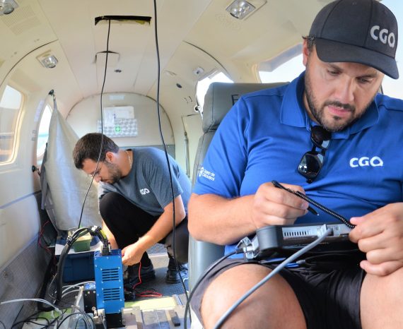
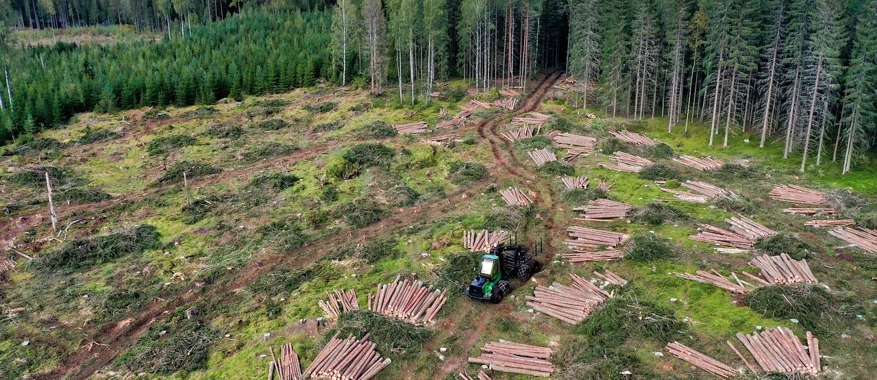
The aim of this project is to determine the post-intervention characteristics required to confirm the operational compliance of an irregular progressive cut (IPC) harvest using high precision drone based multispectral and thermal imagery. The state-of-the-art multispectral and thermal imaging technologies acquired by drones provide an affordable solution to the IPC inventory challenges. They offer great flexibility in acquisition, even in real time on specific territories.
The latest advances in photogrammetry also enable three-dimensional reconstitutions of observed environments, providing data of comparable quality to what lidars can obtain in the right conditions.
Interpretation and monitoring of forest conditions will be enhanced by the use of new data sources and processing techniques combined with advanced image analysis, such as image segmentation and machine learning classification methods.
A drone will be used to take multispectral and thermal images of the study sites before and after logging operations. In order to assess the characteristics of the overflown forest stands, the drone acquisitions will be coordinated with in situ field surveys carried out by foresters.
The drone images will then be processed using a photogrammetry software to create orthomosaics and a digital surface model.
Finally, the data will be analyzed using image processing techniques and machine learning analysis to extract data such as widths of collected strips, collected and residual crowns, and other elements of ecological interest.
Drone DJI Matrice 210 RTK RGB Camera Zenmuse X7
MicaSense Altum multispectral camera. This is a multispectral camera comprising 5 bands in the visible and near-infrared spectrum (blue, green, red, red edge and near infrared) and one in the thermal infrared.
Software: Pix4D, PyTorch
Resource Management
The company intends to establish a geospatial database infrastructure and automate …
This project aims to develop rapid and reliable assessment tools for wild macroalg …
Our team used multispectral aerial imagery as a tool for analyzing and diagnosing …